Footprints Adventure Tours Recommended in several travel guide book
For Our Best Service & Itinerary Design .!

Ladakh Must Visit Destinations Packages

Leh Nubra Valley Pangong Lake Tsomoriri Lake Delhi, India

Ladakh Tour Package

8 days 7 nights

Leh Khardung-La Top

Ladakh Tour Package

4 days 3 nights

Leh Alchi Nubra Valley Pangong Lake Delhi, India

Ladakh Tour Package

8 days 7 nights

Srinagar Kargil Padum Zanskar Kargil Dah & Hanu Leh Pangong Lake

Ladakh Tour Package

8 days 7 nights

Leh They Thiksy Hemis Pangong Lake

Ladakh Tour Package

4 days 3 nights

Leh Nubra Valley Pangong Lake Delhi, India

Ladakh Tour Package

6 days 5 nights

Leh Sham Valley Pangong Lake Nubra Valley Tsomoriri Lake

Ladakh Tour Package

7 days 6 nights

Leh Sham Valley Nubra Valley Pangong Lake Delhi, India

Ladakh Tour Package

6 days 5 nights

Leh Sham Valley Nubra Valley Pangong Lake Delhi, India

Ladakh Tour Package

7 days 6 nights

Leh They Thiksy Hemis Nubra Valley Khardung-La Top

Ladakh Tour Package

5 days 4 nights

Leh Sham Valley Pangong Lake

Ladakh Tour Package

7 days 6 nights

Leh Sham Valley Nubra Valley Pangong Lake

Ladakh Tour Package

8 days 7 nights

Leh Alchi Pangong Lake Khardung-La Top

Ladakh Tour Package

6 days 5 nights

Leh Sham Valley Nubra Valley

Ladakh Tour Package

7 days 6 nights

Delhi, India Sham Valley Nubra Valley Leh Pangong Lake

Ladakh Tour Package

6 days 5 nights

Ladakh Star & Deluxe Hotel Packages

Leh Sham Valley Pangong Lake Khardung-La Top

Ladakh Star Hotel Packages

5 days 4 nights

Leh Pangong Lake Khardung-La Top

Ladakh Deluxe Hotel Packages Family Package

5 days 4 nights

Leh Pangong Lake Khardung-La Top

Ladakh Star Hotel Packages

5 days 4 nights

Leh Pangong Lake Khardung-La Top

Ladakh Star Hotel Packages

5 days 4 nights

Why Book With Us?

 
Best Price Guarantee

 You are guaranteed getting the lowest Ladakh tour package & hotel booking price if book with us, since we are based locally, there is no hidden cost, add-on commissions, or any third party handover of your tours operation.With our payment system you can avail easy EMI options too. We let you travel first and pay later.

 
Trust & Safety

We use the latest line of transport (Innova Zylo cars & Mini turbo bus) well trained drivers with mountain driving license. Our guides are trained for high altitude and mountain sickness rescue.To secure your payments, we use CCAvenue payment gateway with easy EMI.

 
Best Travel Agent

Served more than 1000-plus guest every year, recommended in many tour guide books. We are among the oldest tour companies in Ladakh. Our representative are ready to attain you 24/7 while you're in Ladakh. Booking with us your tour and money is always in safe hand.

About Ladakh

Rock carvings found in many parts of Ladakh indicate that the area has been inhabited from Neolithic times.[12] Ladakh’s earliest inhabitants consisted of a mixed Indo-Aryanpopulation of Mons and Dards,[14] who find mention in the works of Herodotus,[b]NearchusMegasthenesPliny,Ptolemy, and the geographical lists of the Puranas.[15]Around the 1st century, Ladakh was a part of the Kushana empire. Buddhism spread into western Ladakh from Kashmir in the 2nd century when much of eastern Ladakh and western Tibet was still practising the Bon religion. The 7th century Buddhist traveler Xuanzang describes the region in his accounts.[e]

In the 8th century, Ladakh was involved in the clash between Tibetan expansion pressing from the East and Chinese influence exerted from Central Asia through the passes. Suzerainty over Ladakh frequently changed hands between China and Tibet. In 842 Nyima-Gon, a Tibetan royal representative annexed Ladakh for himself after the break-up of the Tibetan empire, and founded a separate Ladakhi dynasty. During this period Ladakh acquired a predominantly Tibetan population. The dynasty spearheaded the second spreading of Buddhism, importing religious ideas from north-west India, particularly from Kashmir. The first spreading of Buddhism was the one in Tibet proper.

According to Rolf Alfred Stein, author of Tibetan Civilization, the area of Zhangzhung was not historically a part of Tibet and was a distinctly foreign territory to the Tibetans. According to Rolf Alfred Stein,[16]

“… Then further west, The Tibetans encountered a distinctly foreign nation — Shangshung, with its capital at Khyunglung. Mt. Kailāśa(Tise) and Lake Manasarovar formed part of this country, whose language has come down to us through early documents. Though still unidentified, it seems to be Indo-European. … Geographically the country was certainly open to India, both through Nepal and by way of Kashmir and Ladakh. Kailāśa is a holy place for the Indians, who make pilgrimages to it. No one knows how long they have done so, but the cult may well go back to the times when Shangshung was still independent of Tibet.
How far Zhangzhung stretched to the north, east and west is a mystery … We have already had an occasion to remark that Shangshung, embracing Kailāśa sacred Mount of the Hindus, may once have had a religion largely borrowed from Hinduism. The situation may even have lasted for quite a long time. In fact, about 950, the Hindu King of Kabulhad a statue of Vişņu, of the Kashmiri type (with three heads), which he claimed had been given him by the king of the Bhota (Tibetans) who, in turn had obtained it from Kailāśa.”

A chronicle of Ladakh compiled in the 17th century called the La dvags royal rabs, meaning the Royal Chronicle of the Kings of Ladakh recorded that this boundary was traditional and well-known. The first part of the Chronicle was written in the years 1610–1640 and the second half towards the end of the 17th century. The work has been translated into English by A. H. Francke and published in 1926 in Calcutta titled the Antiquities of Indian Tibet. In volume 2, the Ladakhi Chronicle describes the partition by King Skyid-lde-ngima-gon of his kingdom between his three sons, and then the chronicle described the extent of territory secured by that son. The following quotation is from page 94 of this book:

He gave to each of his sons a separate kingdom, viz., to the eldest Dpal-gyi-gon, Maryul of Mngah-ris, the inhabitants using black bows; ru-thogs of the east and the Gold-mine of Hgog; nearer this way Lde-mchog-dkar-po; at the frontier ra-ba-dmar-po; Wam-le, to the top of the pass of the Yi-mig rock …

From a perusal of the aforesaid work, It is evident that Rudokh was an integral part of Ladakh. Even after the family partition, Rudok continued to be part of Ladakh. Maryul meaning lowlands was a name given to a part of Ladakh. Even at that time, i.e. in the 10th century, Rudok was an integral part of Ladakh and Lde-mchog-dkar-po, i.e., Demchok was an integral part of Ladakh.

Faced with the Islamic conquest of South Asia in the 13th century, Ladakh chose to seek and accept guidance in religious matters from Tibet. For nearly two centuries till about 1600, Ladakh was subject to raids and invasions from neighbouring Muslim states, which led to the partial conversion of Ladakhis to Noorbakshi Islam.

How To Reach Ladakh

Ladakh by Flight

The nearest airport is at Leh, which is well connected to Delhi, Jammu, Srinagar, Chandigarh, Mumbai . From the Leh airport, hire a cab to reach Leh city has several accommodation options. Nearest Airport: Leh Airport (IXL) - 5 kms from Leh town  

Ladakh by Road

Road If you don't want to take flight, then you will have to reach Manali or Srinagar via trains and buses and then from Manali or Srinagar, you can catch a bus or a cab or even a shared taxi that drops you directly to Leh. The road from Manali to Leh is said to be one of the most picturesque routes of the world. A lot of people cover this route on their motorbikes, especially on Royal Enfield motorcycles as the terrain is a bit bumpy. Some cycle enthusiasts also cover this distance over their bycycles. 

Ladakh by Train

As mentioned, the city is at a very remote location with minimal resources available. So the region does not have a railway station. However, the nearest railway station is Jammu Tawi (700 km from Ladakh) which is well connected with Delhi, Kolkata, and Mumbai.

Commuting Within Ladakh

The mystic and awe striking region of Ladakh is surrounded with gorgeous scenery and travelling through this region can indeed be a pleasure. There are buses, taxis, motorcycles and bicycles available for getting across Ladakh and you can choose the one that you deem fit.

Book Ladakh Star & Deluxe Hotels, Guest Houses, Camps & Homestay

Directly with Local owners in Leh, Kargil, Nubra & Pangong lake

Save upto 25%

Best price - Guaranteed

From Rs.3500 to Rs. 1000 / Room

Know More
 

Travellers Reviews

Unpublished
From Wikipedia, the free encyclopedia
 
 
This article is about a city in India. For other uses, see Kargil (disambiguation).
Kargil
ཀར་གིལ (མཁར་དཀིལ་ལ།) / کرگل
करगिल
city
Kargil
Kargil
Kargil is located in Jammu and Kashmir
Kargil
Kargil
Location in Jammu and Kashmir
Coordinates: 34°33′N 76°08′ECoordinates34°33′N 76°08′E
Country  India
State Jammu and Kashmir
District Kargil
Government
 • Body Ladakh Autonomous Hill Development Council - Kargil (LADAKH)
Area
 • Total 14,086 km2 (5,439 sq mi)
Elevation 2,676 m (8,780 ft)
Population (2011)[1]
 • Total 143,388
 • Density 10/km2 (26/sq mi)
Languages
 • Official {{{demographics1_info1}}}
Time zone IST (UTC+5:30)
Vehicle registration JK07
Website www.kargil.nic.in

Kargil is a city in the Kargil district of Ladakh, in the Indian state of Jammu and Kashmir. It is the second largest town in Ladakh after Leh.[2] It is located 60 km and 204 km from Drass and Srinagar to the west respectively, 234 km from Leh to the east, 240 km from Padum to the southeast and 1,047 km from Delhi to the south.

History[edit]

Present-day Kargil was not the natural capital of the region, or Purig as it was also known. Earlier, Purig consisted of a number of small but independent kingdoms, which included ChiktanPhokhar, Sot and the Suru Valley. These tiny principalities would often fight among themselves over petty issues. Gasho “Thatha Khan”, an exiled prince in the 9th century AD, is perhaps the first ruler who brought together all the territories under a united administration. Another sultan of Purig extended his kingdom to include ZanskarPashkum (Jammu and Kashmir) and Sodh, pretty much the territory of the present Kargil district. He is referred to as “the Purig Sultan”. His capital was based at Karpokhar in the Suru Valley. The other famous kings of Kargil were Boti Khan, Abdal Khan, Amrood Choo, Tsering Malik, Kunchok Sherab Stan and Thi Sultan.[citation needed]

It is said that it was the period of Ali Sher Khan Anchan, the famous ruler of Skardu, in the late 16th and early 17th centuries which had a great influence on the area. This prince from Baltistan conquered most of the principalities of Purig and introduced Balti culture in the Kargil district. Subsequently, it was the Dogras who united Baltistan, Purig, Zanskar and present-day Leh district in the first half of the 19th century under a single administrative unit, which lasted till 1947 when a new line of control was demarcated between India and Pakistan separating Skardu and Kargil.[3][better source needed]

Before the Partition of India in 1947, Kargil was part of the wazarat (district) of Ladakh, a sparsely populated region with diverse linguistic, ethnic and religious groups, living in isolated valleys separated by some of the world's highest mountains. The Ladakh wazarat had three tehsils (sub-districts), named after the cities of their headquarters: LehSkardu and Kargil. The district headquarters shifted between the three locations each year.[4]

 
Location of Kargil with respect to the Line of Control

The First Kashmir War (1947–48) concluded with a ceasefire line that divided the Ladakh wazarat, putting roughly the Kargil and Leh tehsils on the Indian side, and the Skardu tehsil on the Pakistan side. The two Indian tehsils were soon promoted to districts and Ladakh was named a Division, on par with the Jammu and Kashmir Divisions in the Indian state of Jammu and Kashmir. Pakistan renamed the Skardu tehsil Baltistan and divided it into further districts.

At the end of Indo-Pakistani War of 1971, the two nations signed the Simla Agreement, converting the former ceasefire line with some adjustments into a Line of Control, and promising not to engage in armed conflict with respect to that boundary.[5]

 
Indian soldiers in Batalik during the Kargil War

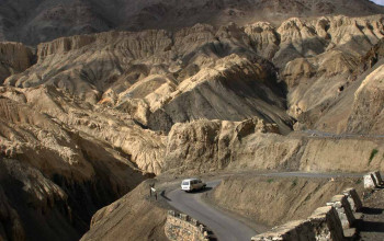
In 1999 the area saw infiltration by Pakistani forces, leading to the Kargil War. Fighting occurred along a 160 km long stretch of ridges overlooking the only road linking Srinagar and Leh.[6] The military outposts on the ridges above the highway were generally around 5,000 metres (16,000 ft) high, with a few as high as 5,485 metres (18,000 ft). After several months of fighting and diplomatic activity, the Pakistani forces withdrew to their side of the Line of Control.[7]
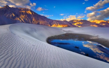
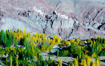
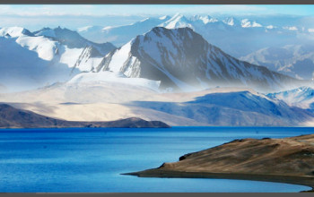
Geography[edit]

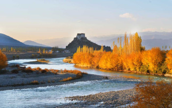
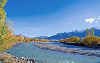
Kargil has an average elevation of 2,676  metres (8,780 feet), and is situated along the banks of the Suru River (Indus). The town of Kargil is located 205 km (127 mi) from Srinagar,[8] facing the Northern Areas across the LOC. Like other areas in the Himalayas, Kargil has a temperate climate. Summers are hot with cool nights, while winters are long and chilly with temperatures often dropping to −48 °C 32 °C(−54 °F).[9]

Demographics[edit]

As per the 2011 census, the population in Kargil had grown by 20.18% to 143,388 people (equal to 1.14% of the total population of Jammu and Kashmir), with children under 6 years constituting 10% of the population.[10] The male-to-female sex ratio was 1,000:776; population density 10 persons/km2.[11] Kargil had an average literacy rate of 74.49% (slightly more than the national average of 74.04%) – male literacy at 86.73% and female literacy at 58.05%.

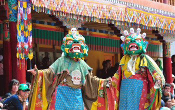
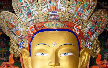
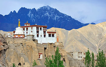
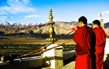
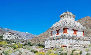
People in Kargil are of mixed Dard and Tibetan descent. Most are Baltis. The inhabitants of Kargil were adherents of Tibetan Buddhism until the 14th-15th centuries when Muslim missionaries began to proselytise to the local people. Today, 90% of Kargil's population are Shia Muslim, 5% Sunni and 5% Tibetan Buddhist. The architecture of older mosques in Kargil combines Tibetan and Mughal styles.
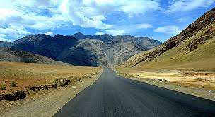
Religions in Kargil
Religion     Percent  
Sikhs
  
0.5%
Muslims
  
95%
Buddhists
  
4.5%
Distribution of religions

Transport[edit]

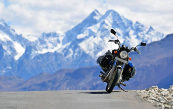
An Indian national highway (NH 1D) connecting Srinagar to Leh cuts through Kargil, as well as an airport.

A famous all-weather road, the Kargil-Skardu road linked Kargil with Skardu, a city in Gilgit-Baltistan. Since the 1948 Kashmir War, the road has been closed. Whilst the Indian Government has been interested in opening the road as a humanitarian gesture, this has been refused by the Pakistani Government.[12][13][14]

Gallery[edit]